Satellite detected water over Beledweyne City, Hiraan Region of Somalia as of 25 May 2023
2025年12月2日Huantian Intelligence is expected to establish the second largest commercial satellite constellation in China (commercial satellite)
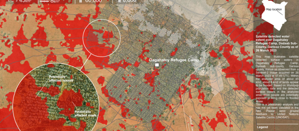
2025年12月3日This map illustrates satellite detected surface waters in Dagahaley Refugee Camp, Dadaab sub-county, Garissa county, Kenya as observed from a Sentinel-2 image acquired on 26 March 2023 at 07:49 UTC. Within the analyzed area of about 45 km2, about 8 km2 of lands appear to be flooded. Based on Worldpop population data and the detected surface waters in the analyzed area, 8600 people are potentially exposed or living close to flooded areas. This is a preliminary analysis and has not yet been validated in the field. Please send ground feedback to United Nations Satellite Centre (UNOSAT).