The nation’s first commercial satellite full-industry-chain “supermarket” goes online
2025年10月16日Satellite detected water extent over Dagahaley Refugee Camp, Garissa County, Kenya as of 26 March 2023
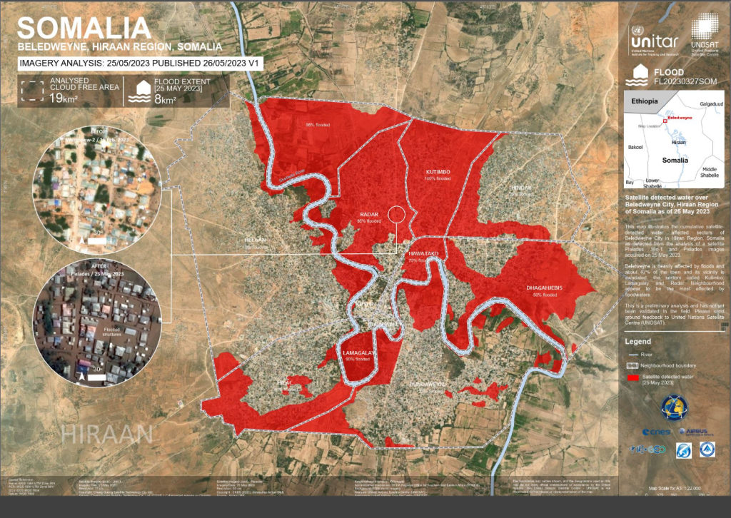
2025年12月2日This map illustrates the cumulative satellite-detected water affected sectors of Beledweyne City in Hiiran Region. Beletweyne is heavily affected by floods and about 42% of the town and its vicinity is inundated; the sectors called Kutimbo, Lamagalay and Radar Neighbourhood appear to be the most affected by floodwaters. This is a preliminary analysis and has not yet been validated in the field. Please send ground feedback to United Nations Satellite Centre (UNOSAT).Download Files